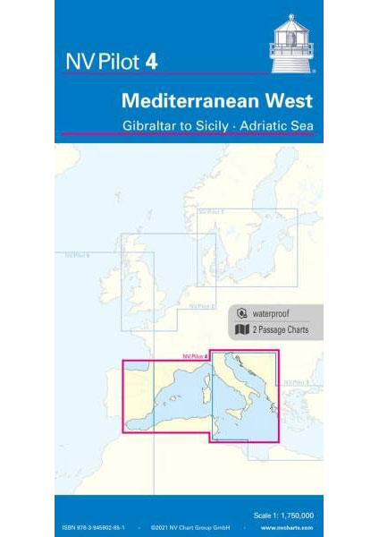
The Pilot 4 is ideal as a planning chart for traveling the western Mediterranean. The east coast of Spain, the south coast of France and Italy are covered in this oversailor. You can also find the Balearic Islands, Corsica, Sardinia and Sicily there.
This folding chart consists of two overview charts:
Chart 1, scale 1: 175 million> Tire Sea, Adriatic Sea, Ionian Sea and waters south of Sicily to the coast of Tunisia.
Chart 2, scale 1: 1.75 million> western Mediterranean from Gibraltar to Palermo (Sicily)
The beacons and routes, including distances, that are important for planning the passage are shown on both charts. The terms are in English. The chart is in A1 format, folded approx. 15 x 30 cm.